![](/images/other/stat-length.png)
![Excursión Senderismo La Grave - Le Lac Noir du Plateau d'Emparis par Le Chazelet - Photo](https://media.geolcdn.com/t/1900/400/ext.pjpeg?maxdim=2&url=https%3A%2F%2Fstatic1.geolcdn.com%2Fsiteimages%2Fupload%2Ffiles%2F1553511878bg_sport_marche.png)
Le Lac Noir du Plateau d'Emparis par Le Chazelet
lirycle
Usuario
![Longitud](/images/other/stat-length.png)
![Altitud máxima](https://static1.geolcdn.com/siteimages/upload/files/1508320355ic_sort_altitude_max_24dp.png)
![Desnivel positivo](https://static1.geolcdn.com/siteimages/upload/files/1508320355ic_sort_den_pos_24dp.png)
![Km-Effort](/images/other/stat-length.png)
![Altitud mínima](https://static1.geolcdn.com/siteimages/upload/files/1508320355ic_sort_altitude_min_24dp.png)
![Desnivel negativo](https://static1.geolcdn.com/siteimages/upload/files/1508320355ic_sort_den_neg_24dp.png)
![Boucle](https://static1.geolcdn.com/siteimages/upload/files/16400158638029165_repeat_loop_refresh_sync_direction_icon.png)
![Senderismo](https://static1.geolcdn.com/sitytour/trail-icons/101.png)
5h30
Dificultad : Medio
![Escanee este código QR para abrir la excursión en la aplicación SityTrail](https://capi.geolives.com/qq0zvz2zws4bq2lad0pu/sitytour/trails/207476/qr.png?size=200)
Aplicación GPS de excursión GRATIS
A propósito
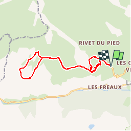
Ruta Senderismo de 15,1 km a descubrir en Provenza-Alpes-Costa Azul, Altos Alpes, La Grave. Esta ruta ha sido propuesta por lirycle.
Descripción
Montée
Du parking du Chazelet, descendre jusqu'au départ du téléski. Traversez le pont qui enjambe le torrent du Gâ puis suivre le GR54 en direction du plateau d'Emparis (fléché). La montée s'effectue tranquillement en de larges lacets pour atteindre après une 1H00 de marche le Pré-Veyraud. Ensuite, le sentier prend peu de dénivelé à travers cette belle pelouse alpine. Arrivé à la bifurcation prenez la direction du col du Souchet sur la droite. Au col n'hésitez pas à admirer la vue sur le plateau d'Emparis, puis tournez à gauche direction les lacs ou en coupant facilement vers le haut de ce même sentier, pour rejoindre un autre sentier qui arrive d'abord au lac Noir (conseillé). Arrivé au sommet de la bosse vous apercevrez en contrebas le lac Noir ainsi que sur votre droite les trois autres petits lacs. Contournez le lac Noir par votre gauche, puis descendez par le sentier pour atteindre le lac Lérié.
Descente
Suivre le sentier qui descend en partant Nord-Est et qui rejoind rapidement l'itinéraire de montée.
Remarques :
Le panorama est magnifique sur les Écrins, avec en particulier la Meije et le Râteau ainsi que les nombreux glaciers. Une randonnée à ne pas manquer dans ce secteur privilégié, le plateau d'Emparis, face à la Majesté la Meije.
Localización
Comentarios
Excursiones cerca
![Excursión Senderismo Villar-d'Arêne - L'Aiguillon et Lac du Pontet 28.8.22 - Photo](https://media.geolcdn.com/t/375/260/007e50a5-b3c9-4529-9bf1-1ab760d39579.jpg&format=jpg&maxdim=2)
![Senderismo Senderismo](https://static1.geolcdn.com/sitytour/trail-icons/101.png)
Senderismo
![](/images/other/stat-length.png)
![](https://static1.geolcdn.com/siteimages/upload/files/16400158638029165_repeat_loop_refresh_sync_direction_icon.png)
![Excursión Senderismo La Grave - L'aiguille du Goléon - Photo](https://media.geolcdn.com/t/375/260/ext.jpg?maxdim=2&url=https%3A%2F%2Fservices.sitytrail.com%2FGeolivesWS%2FDownloadMedia.ashx%3FTrailID%3D101222%26Media%3D710_2.jpg)
![Senderismo Senderismo](https://static1.geolcdn.com/sitytour/trail-icons/101.png)
Senderismo
![](/images/other/stat-length.png)
![](https://static1.geolcdn.com/siteimages/upload/files/16400158638029165_repeat_loop_refresh_sync_direction_icon.png)
![Excursión Senderismo La Grave - 05 lac goleon - Photo](https://media.geolcdn.com/t/375/260/abf8f99e-f4a4-42bd-8090-69a0a4a7cd63.jpg&format=jpg&maxdim=2)
![Senderismo Senderismo](https://static1.geolcdn.com/sitytour/trail-icons/101.png)
Senderismo
![](/images/other/stat-length.png)
![](https://static1.geolcdn.com/siteimages/upload/files/16400158638029165_repeat_loop_refresh_sync_direction_icon.png)
![Excursión Senderismo La Grave - 05 refuge e chancel - Photo](https://media.geolcdn.com/t/375/260/e45ae6e7-d20c-4652-ac11-0baa8b6d8886.jpg&format=jpg&maxdim=2)
![Senderismo Senderismo](https://static1.geolcdn.com/sitytour/trail-icons/101.png)
Senderismo
![](/images/other/stat-length.png)
![](https://static1.geolcdn.com/siteimages/upload/files/16400158638029165_repeat_loop_refresh_sync_direction_icon.png)
![Excursión Senderismo La Grave - vallons de la Meije : lac Puy Vachère - Photo](https://media.geolcdn.com/t/375/260/67d29b46-abdb-45ba-9c3a-55e84b743ed6.jpg&format=jpg&maxdim=2)
![Senderismo Senderismo](https://static1.geolcdn.com/sitytour/trail-icons/101.png)
Senderismo
![](/images/other/stat-length.png)
![](https://static1.geolcdn.com/siteimages/upload/files/16400158638029165_repeat_loop_refresh_sync_direction_icon.png)
![Excursión A pie La Grave - Le Chazelet - Refuge du Pic du Mas de la Grave en boucle - Photo](https://media.geolcdn.com/t/375/260/52a9a626-d23a-47b8-b762-a5eff72b3bed.jpg&format=jpg&maxdim=2)
![A pie A pie](https://static1.geolcdn.com/sitytour/trail-icons/100.png)
A pie
![](/images/other/stat-length.png)
![](https://static1.geolcdn.com/siteimages/upload/files/16400158638029165_repeat_loop_refresh_sync_direction_icon.png)
![Excursión Senderismo Villar-d'Arêne - SityTrail - Lac du pontet et l'Aiguillon - Photo](https://media.geolcdn.com/t/375/260/ext.jpg?maxdim=2&url=https%3A%2F%2Fstatic1.geolcdn.com%2Fsiteimages%2Fupload%2Ffiles%2F1553511878bg_sport_marche.png)
![Senderismo Senderismo](https://static1.geolcdn.com/sitytour/trail-icons/101.png)
Senderismo
![](/images/other/stat-length.png)
![](https://static1.geolcdn.com/siteimages/upload/files/16400158638029165_repeat_loop_refresh_sync_direction_icon.png)
![Excursión Senderismo La Grave - 2020-09-03 Marche Tour de la Grave au plateau d'Emparis par le Pic du Mas de la Grave (3 jours) - Photo](https://media.geolcdn.com/t/375/260/db3fb938-b4cb-4c23-b152-eb22bce76ff5.jpg&format=jpg&maxdim=2)
![Senderismo Senderismo](https://static1.geolcdn.com/sitytour/trail-icons/101.png)
Senderismo
![](/images/other/stat-length.png)
![](https://static1.geolcdn.com/siteimages/upload/files/16400158638029165_repeat_loop_refresh_sync_direction_icon.png)
![Excursión Senderismo La Grave - 2020-09-03 Marche La Grave au Refuge du Pic du Mas de la Grave - Photo](https://media.geolcdn.com/t/375/260/47845ef7-2166-466b-bb9f-8b90b012e6e1.jpg&format=jpg&maxdim=2)
![Senderismo Senderismo](https://static1.geolcdn.com/sitytour/trail-icons/101.png)
Senderismo
![](/images/other/stat-length.png)
![](https://static1.geolcdn.com/siteimages/upload/files/16400158638029165_repeat_loop_refresh_sync_direction_icon.png)